Florida Panhandle Shipwreck Trail
$10.95 USD
ISBN: 9781989693803
Language: English
Authors: Ian Popple, Otto Wagner, Peter McDougall
Dimensions: 5.5 inches x 8.5 inches
Description: Waterproof cards printed on plastic or laminated synthetic paper
Shipping: Shipped from our distribution center within one week. Shipping time depends on location.
Card overview:
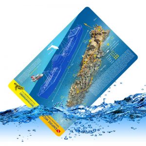
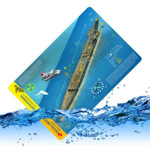
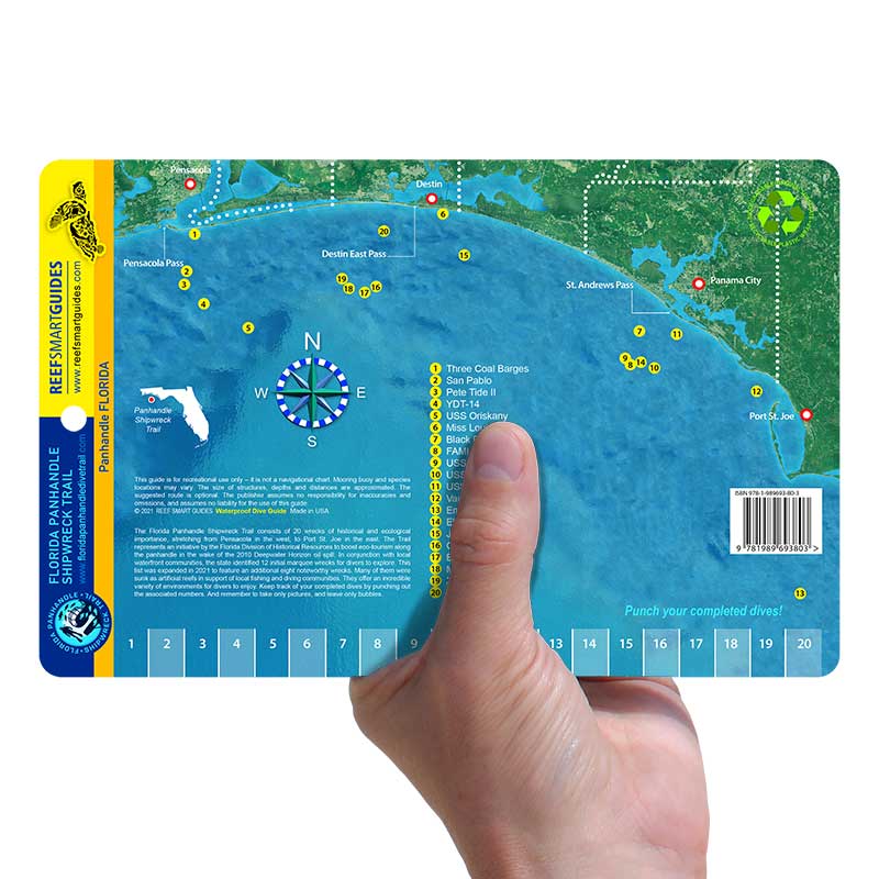
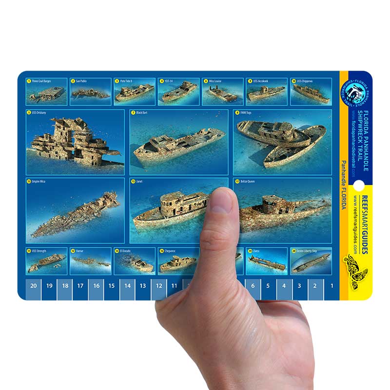
The Florida Panhandle Shipwreck Trail card contains 3D models 20 of the region’s premier wreck sites. The card also contains a regional map showing where these sites are located geographically. A numbered rail along the bottom edge allows divers to punch a hole in the card, in order to keep track of the sites they have visited. The card features:
- 3D-rendered images of 20 wrecks
- Geographic location of each wreck on a regional map
- Description about the Florida Panhandle Shipwreck Trail
- Hole punch bar to keep track of the sites visited
Be sure to check out our other dive cards featuring popular wrecks and reefs in other parts of Florida.
Description
Series Overview:
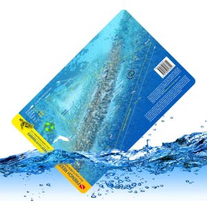
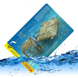
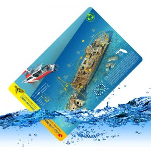
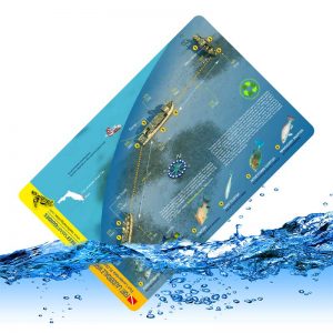
Exploring a new environment is an exhilarating experience. But there’s just so much to see and it can be hard to remember all the key information about a reef or wreck when you finally head into the water. Having that information readily available while in the water can improve safety and vastly improve your experience. Our waterproof cards are printed on plastic or laminated synthetic paper so that you can take them with you while you dive or swim. Each card includes valuable information such as:
- A 3D-image fully rendered of the individual reef or wreck that highlights many of the key features at a given site
- A brief description about the history of the wreck or key information about the reef
- The important depth information for that site
- Information about key species found in the region
- A suggested route that is popular with most divers and snorkelers
Additional information
| Weight | 0.8 oz |
|---|---|
| Dimensions | 8.5 × 5.5 × 0.04 in |
Related products