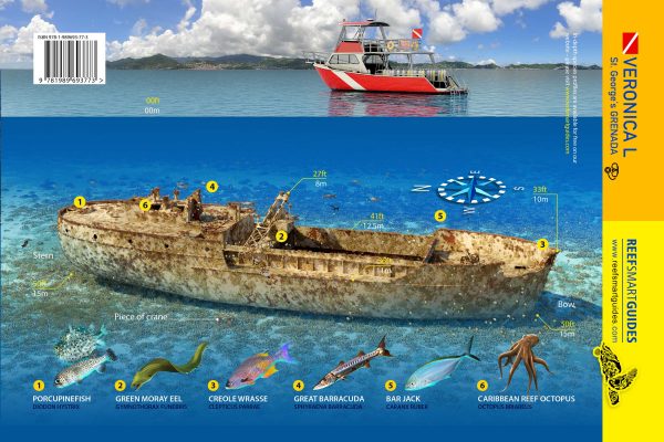
 Detail of the waterproof card for Veronica L in Grenada. Reef Smart Guides ©
Reef Smart has created the first dive and snorkel site maps using our new
remote mapping process. The two sites that have been modelled using this technique are the
Mr. Bud wreck in Roatan, developed with the assistance of Patric Lengacher, and the
Veronica L wreck in Grenada, developed with the assistance of local dive operator
Eco Dive. Both of these new sites are now available as waterproof cards through our
online store (see links below).
“We developed the concept of remote mapping last year in response to the COVID-19 pandemic, which severely disrupted our travel plans and threatened to delay many of our ongoing mapping projects,” explains Ian Popple, Reef Smart managing director. “This new technique involves training local partners online to collect the data we need to develop 3D models of their dive and snorkel sites.”
“It’s a collaborative effort that represents a win-win for all parties,” says Reef Smart USA director Peter McDougall. “The early trials conducted in Grenada and Roatan have proven incredibly successful and we will be looking to extend the concept of remote mapping into many new areas next year and beyond.”
Additional training has already been conducted with a team in Cyprus, who are in the process of collecting data for a number of the island’s top wreck sites. Conversations are also underway with potential partners in the Great Lakes area of North America, as well as Hawaii and Vancouver. Remote mapping represents an exciting new chapter for Reef Smart and our partners and we look forward to producing many new dive and snorkel site maps using this technique.
Click the links to purchase waterproof cards of
Mr. Bud and
Veronica L. These brand-new cards are available for purchase now, and will ship on September 15, 2021.
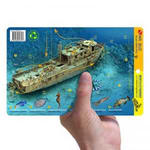 Mr. Bud in Roatan. Reef Smart Guides ©
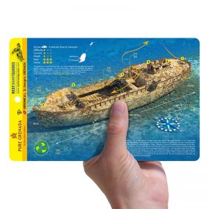 Veronica L in Grenada. Reef Smart Guides ©